Admiralty Charts & Portfolios
-

ADMIRALTY Chart 1127: Outer Approaches to the North Channel
Admiralty
AED184.76ADMIRALTY Chart 1127: Outer Approaches to the North Channel Specifications Scale: 1:500000 Manufacturer: ADMIRALTY Publisher: ADMIRALTY Author: UK Hydrographic Office Edition: Jul-15 Format: Folded to approximately 71.5 x...49624/03AED184.76 -

ADMIRALTY Chart 1123: Western Approaches to Saint George's Channel and Bristol Channel
Admiralty
AED184.76ADMIRALTY Chart 1123: Western Approaches to Saint George's Channel and Bristol Channel. Specifications Scale: 1:500000 Manufacturer: ADMIRALTY Publisher: ADMIRALTY Author: UK Hydrographic Office Edition: Feb-17...49624AED184.76 -

ADMIRALTY Chart 1121: Irish Sea with Saint George's Channel and North Channel
Admiralty
AED184.76ADMIRALTY Chart 1121: Irish Sea with Saint George's Channel and North Channel Specifications Scale: 1:500000 Manufacturer: ADMIRALTY Publisher: ADMIRALTY Author: UK Hydrographic Office Edition: Nov-17 Format: Folded to...49623AED184.76 -

ADMIRALTY Chart 1104: Bay of Biscay
Admiralty
AED184.76ADMIRALTY Chart 1104: Bay of Biscay Specifications Scale: 1:1000000 Manufacturer: ADMIRALTY Publisher: ADMIRALTY Author: UK Hydrographic Office Edition: Nov-13 Format: Folded to approximately 71.5 x 53.5cm, containing at...49622/2AED184.76 -

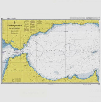
ADMIRALTY Chart 773: Strait of Gibraltar to Isla de Alboran
Admiralty
AED184.76ADMIRALTY Chart 773: Strait of Gibraltar to Isla de Alboran Specifications Scale: 1:300000 Manufacturer: ADMIRALTY Publisher: ADMIRALTY Author: UK Hydrographic Office Edition: Apr-18 Format: Folded to approximately 71.5 x...49621/2AED184.76 -

ADMIRALTY Chart 633: Plans on the East Coast of Ireland
Admiralty
AED184.76ADMIRALTY Chart 633: Plans on the East Coast of Ireland Specifications Scale: 1:25000 Manufacturer: ADMIRALTY Publisher: ADMIRALTY Author: UK Hydrographic Office Edition: Jan-14 Format: Folded to approximately 71.5 x 53...49620AED184.76 -

ADMIRALTY Chart 259: Baltic Sea
Admiralty
AED184.76ADMIRALTY Chart 259: Baltic Sea Specifications Scale: 1:1500000 Manufacturer: ADMIRALTY Publisher: ADMIRALTY Author: UK Hydrographic Office Edition: Jul-16 Format: Folded to approximately 71.5 x 53.5cm, containing at least...49619/06AED184.76 -

ADMIRALTY Chart 44: Nose of Howth to Ballyquintin Point
Admiralty
AED184.76ADMIRALTY Chart 44: Nose of Howth to Ballyquintin Point Specifications Scale: 1:100000 Manufacturer: ADMIRALTY Publisher: ADMIRALTY Author: UK Hydrographic Office Edition: Aug-16 Format: Folded to approximately 71.5 x 53...49618AED184.76 -

ADMIRALTY Chart 883: Saint Mary's and the Principal Off-Islands
Admiralty
AED184.76ADMIRALTY Chart 883: Saint Mary's and the Principal Off-Islands Features Scale: 1:12500 Manufacturer: ADMIRALTY Publisher: ADMIRALTY Author: UK Hydrographic Office Edition: Mar-19 Format: Folded to approximately 71.5 x 53...49586AED184.76 -

ADMIRALTY Chart 34: Isles of Scilly
Admiralty
AED176.89ADMIRALTY Chart 34: Isles of Scilly Specifications Scale: 1:25000 Manufacturer: ADMIRALTY Publisher: ADMIRALTY Author: UK Hydrographic Office Edition: May-19 Format: Folded to approximately 71.5 x 53.5cm, containing at...49585AED176.89 -

ADMIRALTY International Code of Signals IMO994E
Admiralty
AED302.97ADMIRALTY International Code of Signals IMO994E. This edition of the Code incorporates all amendments adopted by the Maritime Safety Committee up to 2000. The Code is intended for communications between ships, aircraft and authorities ashore...49578AED302.97 -


Admiralty Tidal Stream Atlas - NP256 Irish Sea & Bristol Channel - NP256
Admiralty
AED102.32Admiralty Tidal Stream Atlas NP256 covering Irish Sea and Bristol Channel - Tidal Stream Atlases include detailed tidal stream direction and strength information for key locations in North West Europe enabling accurate calculation of tidal stream rates...49577AED102.32 -

ADMIRALTY Sailing Directions: Irish Coast Pilot NP40
Admiralty
AED393.52ADMIRALTY Sailing Directions: Irish Coast Pilot NP40 Features NP40 20th Edition 2016 Specifications Edition: 2016 ISBN: 9780707743752 Publisher: ADMIRALTY Manufacturer: No Author: UK Hydrographic...49568AED393.52 -

Kelvin Hughes Map/Chart Cover
AED118.06 - AED236.11- Designed for use with Imray Charts and Admiralty Charts- Magnetic edging to secure your charts- Transparent on both sides to easily move between charts- UV-resistant and ideal for marine environments- Always dry, clean & free of creases- Staedtler...4986AED118.06 - AED236.11


