Electronic Charts
CH Marine is a program facility for Digital Charts from C-Map, Navionics and Garmin - Selecting a Chart can be complex, as there a number of critical selection processes to ensure you get the right chart to match and be compatible to your chart plotter or device.
These selection processes include: Type of chart, Sea area of chart, Size of chart, Type of card, Size of card and compatabilty of equipment
Please be aware that all electronic chart purchases are programmed and downloaded software and as a result are non-refundable.
But please do not worry, as we are here to help and answer any questions you may have.
-

C-Map XL Discover- Central & Western Europe - M-EW-Y060-MS
C-Map
Current Stock: 0€227.95C-MAP DISCOVER M-EW-Y060-MS - Suits Lowrance®, B&G®, Simrad®-Full-featured Vector Charts with High-Res Bathy, including integrated Genesis® social data, subscription-free Easy Routing™ and Custom Depth Shading Features Full...57799/DISCOVER€227.95 -

Navionics Platinum+ UK, Ireland & Holland - MSD/SD Card
Navionics
Current Stock: 2€380.00Detailed coverage of the UK, Ireland and the North Sea and English Channel coasts. Coverage includes the Shetland Islands, Orkney Islands, Isle of Man, Isle of Wight, the Isles of Scilly, the Channel Islands, the Thames River, the IJsselmeer, the...g010-c1350-40€380.00 -

Navionics Platinum+ Ireland West Coast Chart - MSD/SD Card
Navionics
Current Stock: 0€257.00Coastal coverage of the north and western coasts of Ireland from Cork to Belfast including the entire Shannon Inland and Shannon-Erne Waterways, Galway Bay and Lough Neagh. Also included is the southwestern Scottish coast from Colonsay to Campbelltown...G010-C1312-40€257.00 -

Navionics+ Blank Regular Programmable Chart
Navionics
Current Stock: 6€175.00This chart can be programmed to any Navionics+ Regular Area Globally, Please contact us for more information Check Your Compatability Suited to most modern systems, including Lowrance, B&G, Simrad and Raymarine. However, you can check you plotter...G010-13220-00€175.00 -

Navionics+ Blank Large Programmable Chart
Navionics
Current Stock: 4€275.00This chart can be programmed to any Navionics+ Large Area Globally, Please contact us for more information Check Your Compatability Suited to most modern systems, including Lowrance, B&G, Simrad and Raymarine. However, you can check you plotter...G010-13224-00€275.00 -

Garmin BlueChart G3 - Europe Atlantic Coast - VEU722L
Garmin
Current Stock:€433.00Unparalleled coastal chart coverage Provides industry-leading coverage, clarity and detail with updated coastal charts that feature integrated Garmin and Navionics® data Auto Guidance1 technology calculates a route using your desired depth and...G010-C1156-00€433.00 -

Garmin BlueChart G3 - Ireland West Coast
Garmin
Current Stock: 2€178.00Unparalleled coastal chart coverage Provides industry-leading coverage, clarity and detail with updated coastal charts that feature integrated Garmin and Navionics® data Auto Guidance1 technology calculates a route using your desired depth and...G010-C0764-20€178.00 -

Garmin BlueChart G3 - Irish Sea
Garmin
Current Stock: 2€178.00Unparalleled coastal chart coverage Provides industry-leading coverage, clarity and detail with updated coastal charts that feature integrated Garmin and Navionics® data Auto Guidance1 technology calculates a route using your desired depth and...G010-C0763-20€178.00 -

C-Map Discover X Chart UK & Ireland M-EW-T-226-D-MS
C-Map
Current Stock: 2€159.95The C-Map Discover X charts exclusively for Simrad® NSX and the new B&G Zeus S Models covering UK & Ireland Model EW-T-226-R (SD-CARD version) C-MAP® DISCOVER™ X offers a fresh, dynamic experience. With the latest vector data,...57798/Discover X€159.95 -
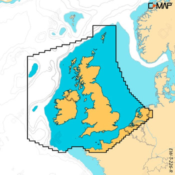

C-Map Reveal X Chart UK & Ireland M-EW-T-226-R-MS
C-Map
Current Stock: 6€250.95The C-Map Reveal X charts exclusively for Simrad® NSX and the new B&G Zeus S Models covering UK & Ireland Model EW-T226 (SD-CARD version) C-MAP® REVEAL™ X offers a fresh, dynamic experience. All the great features from...57798/Reveal X€250.95 -
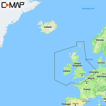

C-MAP Reveal Chart UK & Ireland - M-EW-Y226-MS
C-Map
Current Stock: 8€244.95Whether cruising, fishing or sailing, C-MAP® REVEAL™ charts offer the very best of C-MAP. With Shaded Relief, including game-changing Reveal Seafloor Imagery, Aerial Photography, Satellite Overlay and Dynamic Raster Chart presentation added to...57798/Reveal€244.95 -

Navionics Platinum+ Italy / Adriatic Sea Chart - MSD/SD Card
Navionics
Current Stock: 1€257.00Navionics Platinum+ Italy / Adriatic Sea Coastal coverage of the Po River and the Adriatic coast of Italy, Slovenia, Croatia, Albania, the western coast of Greece and southern Italy. Coverage includes eastern Sicily, the Straits of Messina, the Dalmatian...G010-C1318-40€257.00 -

Navionics+ Ireland, UK and Holland Chart - MSD/SD Card
Navionics
Current Stock: 5€275.00Navionics+ Ireland, UK and Holland All-in-one max detailed cartography for marine and lakes makes Navionics+ the perfect choice for cruising, fishing and sailing. Get the most accurate navigational data for your GPS plotter, an...G010-C1350-30€275.00 -
LowranceC-Map offer


C-MAP Discover Chart UK & Ireland - EW-Y200-MS
C-Map
Current Stock: 11€150.00Whether cruising, fishing or sailing, C-MAP® DISCOVER™ offers a choice of coverages and includes all of the core features you need to make the most of your time on the water. DISCOVER has the very best of C-MAP High-Res Bathymetry, including...57798/Discover€150.00 -

Navionics+ Marine Chart - Ireland West Coast
Navionics
Current Stock: 0€175.00Coastal coverage of the north and western coasts of Ireland from Cork to Belfast including the entire Shannon Inland and Shannon-Erne Waterways, Galway Bay and Lough Neagh. Also included is the southwestern Scottish coast from Colonsay to Campbelltown...G010-C1312-30€175.00 -
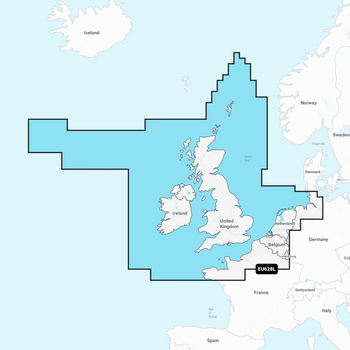
Garmin Navionics+ Chart - IRL , UK & NL
Garmin
Current Stock: 10€280.95Garmin Navionics Vision+ Electronic Chart NVEU004R has coastal coverage of the eastern coast of Ireland, the western coast of Britain, including the Isle of Man and Isles of Scilly. Coverage is from Port Ellen on the Isle of Islay to Falmouth in Britain...G010-C1271-20€280.95 -
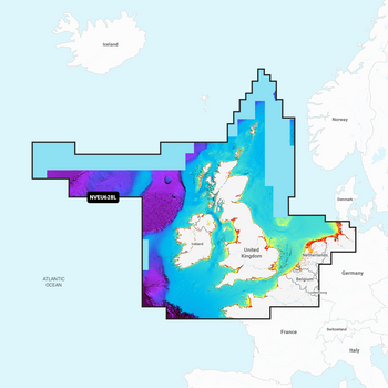
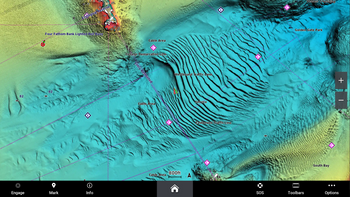
Garmin Navionics Vision+ Chart - IRL , UK & NL
Garmin
Current Stock: 1€389.95Garmin Navionics Vision+ Electronic Chart NVEU004R has coastal coverage of the eastern coast of Ireland, the western coast of Britain, including the Isle of Man and Isles of Scilly. Coverage is from Port Ellen on the Isle of Islay to Falmouth in Britain...G010-C1271-00€389.95 -


Garmin Navionics Vision+ Electronic Chart - UK, IRL Rivers & Lakes
Navionics
Current Stock: 0€292.95Garmin Navionics Vision+ detailed coverage of major lakes and rivers of the UK and Ireland. Coverage includes the Thames, Medway, Mersey, Avon and Tweed Rivers in the UK and the Shannon River in Ireland. Lake coverage includes Lock Ness, Loch Lochy and...G010-C1267-00€292.95 -

Garmin Navionics+ Chart - Ireland West Coast NSEU075R
Garmin
Current Stock: 3€182.95Garmin Navionics+ Electronic Chart NSU075R - Coastal coverage of the north and western coasts of Ireland from Cork to Belfast including the entire Shannon Inland and Shannon-Erne Waterways, Galway Bay and Lough Neagh. Also included is the southwestern...G010-C1233-20€182.95 -
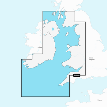
Garmin Navionics+ Chart - Irish Sea NSEU004R
Garmin
Current Stock: 7€182.95Garmin Navionics Electronic Chart NSEU004R has coastal coverage of the eastern coast of Ireland, the western coast of Britain, including the Isle of Man and Isles of Scilly. Coverage is from Port Ellen on the Isle of Islay to Falmouth in Britain and from...G010-C1232-20€182.95 -
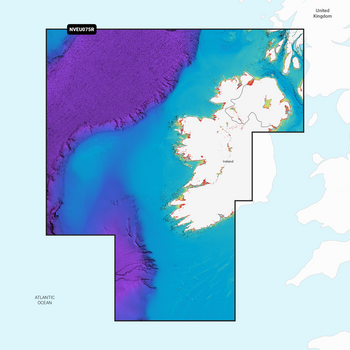
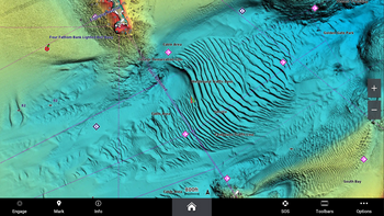
Garmin Navionics Vision+ Chart - Ireland West Coast
Navionics
Current Stock: 6€292.95Garmin Navionics Vision+ Electronic Chart NVEU075R - Coastal coverage of the north and western coasts of Ireland from Cork to Belfast including the entire Shannon Inland and Shannon-Erne Waterways, Galway Bay and Lough Neagh. Also included is the...G010-C1233-00€292.95 -
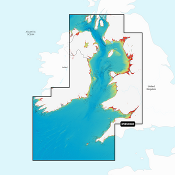
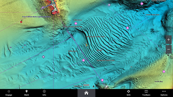
Garmin Navionics Vision+ Chart - Irish Sea
Navionics
Current Stock: 9€292.95Garmin Navionics Vision+ Electronic Chart NVEU004R has coastal coverage of the eastern coast of Ireland, the western coast of Britain, including the Isle of Man and Isles of Scilly. Coverage is from Port Ellen on the Isle of Islay to Falmouth in Britain...G010-C1232-00€292.95 -
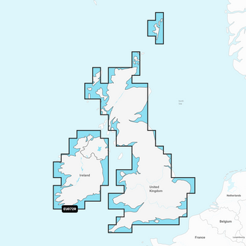
Garmin Navionics+ Chart - UK, IRL Rivers & Lakes
Garmin
Current Stock: 1€182.95Garmin Navionics + Chart NSEU072R with detailed coverage of major lakes and rivers of the UK and Ireland. Coverage includes the Shannon River in Ireland and the Thames, Medway, Mersey, Avon and Tweed Rivers in the UK. Lake coverage includes Lock Ness,...G010-C1267-20€182.95 -

Navionics+ Marine Chart - Irish Sea
Navionics
Current Stock: 0€175.00Coastal coverage of the western coast of Britain and the eastern coast of Ireland including the Isle of Man and Isles of Scilly. Coverage is from Port Ellen on the Isle of Islay to Falmouth in Britain and from Fanad Head to Kenmare Bay in Ireland...G010-C1311-30€175.00


