Admiralty Charts & Portfolios
-


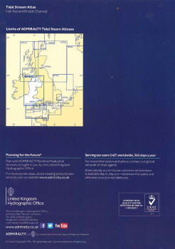
Admiralty Tidal Stream Atlas - NP256 Irish Sea & Bristol Channel - NP256
Admiralty
€26.00Admiralty Tidal Stream Atlas NP256 covering Irish Sea and Bristol Channel - Tidal Stream Atlases include detailed tidal stream direction and strength information for key locations in North West Europe enabling accurate calculation of tidal stream rates...49577€26.00 -

Kelvin Hughes Map/Chart Cover
€30.00 - €60.00- Designed for use with Imray Charts and Admiralty Charts- Magnetic edging to secure your charts- Transparent on both sides to easily move between charts- UV-resistant and ideal for marine environments- Always dry, clean & free of creases- Staedtler...4986€30.00 - €60.00 -

ADMIRALTY Chart 34: Isles of Scilly
Admiralty
€44.95ADMIRALTY Chart 34: Isles of Scilly Specifications Scale: 1:25000 Manufacturer: ADMIRALTY Publisher: ADMIRALTY Author: UK Hydrographic Office Edition: May-19 Format: Folded to approximately 71.5 x 53.5cm, containing at...49585€44.95 -

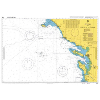
ADMIRALTY Chart 2663: Ile D'Yeu to Pointe de la Coubre
Admiralty
€46.95ADMIRALTY Chart 2663: Ile D'Yeu to Pointe de la Coubre Specifications Scale: 1:200000 Manufacturer: ADMIRALTY Publisher: ADMIRALTY Author: UK Hydrographic Office Edition: Aug-13 Format: Folded to approximately 71.5 x...49717€46.95 -

ADMIRALTY Chart 1104: Bay of Biscay
Admiralty
€46.95ADMIRALTY Chart 1104: Bay of Biscay Specifications Scale: 1:1000000 Manufacturer: ADMIRALTY Publisher: ADMIRALTY Author: UK Hydrographic Office Edition: Nov-13 Format: Folded to approximately 71.5 x 53.5cm, containing at...49622/2€46.95 -

ADMIRALTY Chart 1121: Irish Sea with Saint George's Channel and North Channel
Admiralty
€46.95ADMIRALTY Chart 1121: Irish Sea with Saint George's Channel and North Channel Specifications Scale: 1:500000 Manufacturer: ADMIRALTY Publisher: ADMIRALTY Author: UK Hydrographic Office Edition: Nov-17 Format: Folded to...49623€46.95 -

ADMIRALTY Chart 1123: Western Approaches to Saint George's Channel and Bristol Channel
Admiralty
€46.95ADMIRALTY Chart 1123: Western Approaches to Saint George's Channel and Bristol Channel. Specifications Scale: 1:500000 Manufacturer: ADMIRALTY Publisher: ADMIRALTY Author: UK Hydrographic Office Edition: Feb-17...49624€46.95 -

ADMIRALTY Chart 1125: Western Approaches to Ireland
Admiralty
€46.95ADMIRALTY Chart 1125: Western Approaches to Ireland Specifications Scale: 1:500000 Manufacturer: ADMIRALTY Publisher: ADMIRALTY Author: UK Hydrographic Office Edition: Jan-19 Format: Folded to approximately 71.5 x 53.5cm,...49624/1€46.95 -

ADMIRALTY Chart 1127: Outer Approaches to the North Channel
Admiralty
€46.95ADMIRALTY Chart 1127: Outer Approaches to the North Channel Specifications Scale: 1:500000 Manufacturer: ADMIRALTY Publisher: ADMIRALTY Author: UK Hydrographic Office Edition: Jul-15 Format: Folded to approximately 71.5 x...49624/03€46.95 -

ADMIRALTY Chart 1410: Saint George's Channel
Admiralty
€46.95ADMIRALTY Chart 1410: Saint George's Channel Specifications Scale: 1:200000 Manufacturer: ADMIRALTY Publisher: ADMIRALTY Author: UK Hydrographic Office Edition: Jun-17 Format: Folded to approximately 71.5 x 53.5cm,...49625€46.95 -

ADMIRALTY Chart 1411: Irish Sea - Western Part
Admiralty
€46.95ADMIRALTY Chart 1411: Irish Sea - Western Part Specifications Scale: 1:200000 Manufacturer: ADMIRALTY Publisher: ADMIRALTY Author: UK Hydrographic Office Edition: Nov-17 Format: Folded to approximately 71.5 x 53.5cm,...49626€46.95 -

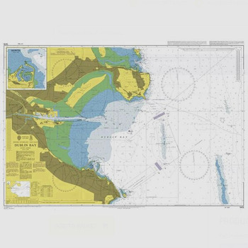
ADMIRALTY Chart 1415: Dublin Bay
Admiralty
€46.95ADMIRALTY Chart 1415: Dublin Bay Specifications Scale: 1:25000 Manufacturer: ADMIRALTY Publisher: ADMIRALTY Author: UK Hydrographic Office Edition: Mar-12 Format: Folded to approximately 71.5 x 53.5cm, containing at least...49628€46.95


