Imray Charts
-

Imray C38 Anse de Bénodet to Presqu'île de Quiberon Chart
Imray
TDD254.23Imray C38 Anse de Bénodet to Presqu'île de Quiberon Chart Includes Port la Forêt (1:15 000) Concarneau (1:15 000) Port Manec’h (1:35 000) Ports Brigneau & Merrien (1:20 000) Doëlan (1:15 000) Îles de Glénan...49538TDD254.23 -

Imray C37 Raz de Sein to Benodet Chart
Imray
TDD254.23Imray C37 Raz de Sein to Benodet Chart Includes Ile de Sein (1:35 000) Audierne (1:20 000) St Guénole (1:45 000) Le Guilvinec (1:20 000) Lesconil (1:20 000) Loctudy (1:20 000) Bénodet (1:20 000) L’Odet Fleuve (1:55 000) ...49537TDD254.23 -

Imray C36 Iie D'Ouessant to Raz de Sein Chart
Imray
TDD254.23Imray C36 Île d’Ouessant to Raz de Sein Chart Includes Baie de Lampaul (Ouessant) (1:30 000) Port du Conquet (1:20 000) Port de Brest & Marina du Moulin Blanc (1:30 000) Marina du Moulin Blanc (1:9000) Port de Camaret-sur-Mer (1:12...49536TDD254.23 -

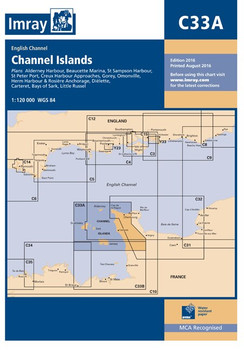
Imray C33A Channel Islands (North) Chart
Imray
TDD254.23Imray C33A Channel Islands (North) Chart Includes Alderney Harbour (1:9000) Beaucette Marina (1:15 000) St Sampson Harbour (1:20 000) St Peter Port (1:10 000) Creux Harbour Approaches (1:25 000) Gorey (1:20 000) Omonville (1:7000) Herm Harbour &...49533TDD254.23 -

Imray C32 Baie de Seine Chart
Imray
TDD254.23Imray C32 Baie de Seine Chart Includes Le Havre Yacht Harbour (1:10 000) Honfleur (1:15 000) Deauville/Trouville (1:15 000) Dives-sur-Mer (1:50 000) Ouistreham (1:25 000) Courseulles-sur-Mer (1:20 000) Arromanches (1:35 000) Port-en-Bessin (1:10 000)...49532TDD254.23 -

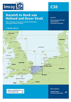
Imray C30 Harwich to Hoek van Holland and Dover Strait Chart
Imray
TDD254.23Imray C30 Harwich to Hoek van Holland and Dover Strait Chart Includes Dunkerque (1:25 000) Nieuwpoort (1:30 000) Oostende (1:20 000) Blankenberge (1:10 000) Zeebrugge (1:35 000) Breskens (1:12 500) Vlissingen (1:20 000) Specifications Scale: 1:200 000...49530TDD254.23 -

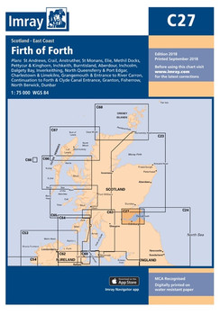
Imray C27 Firth of Forth Chart
Imray
TDD254.23Imray C27 Firth of Forth Chart Includes St Andrews (1:7500) Crail (1:7500) Anstruther (1:7500) St Monans (1:7500) Elie (1:10 000) Methil Docks (1:11 000) Pettycur & Kinghorn (1:17 500) Inchkeith (1:25 000) Burntisland (1:20 000) Aberdour (1:12 500)...49527TDD254.23 -

Imray C23 Fife Ness to Moray Firth Chart
Imray
TDD254.23Imray C23 Fife Ness to Moray Firth Chart Includes Wick Bay (1:10 000) Helmsdale (1:10 000) Inverness Firth (1:75 000) Nairn (1:7500) Burghead (1:8000) Hopeman (1:7500) Lossiemouth (1:7500) Buckie (1:15 000) Banff & Macduff (1:25 000) Fraserburgh...49523TDD254.23 -

Imray C19 A Coruna to Gibraltar Chart
Imray
TDD254.23Imray C19 A Coruña to Gibraltar Chart Includes A Coruña (1:50 000) Baiona (1:85 000) Leixões (1:20 000) Lisboa Approaches (1:65 000) Cascais (1:25 000) Sines (1:30 000) Lagos (1:30 000) Bahía de Cádiz (1:55 000) Rota...49519TDD254.23 -

Imray C18 Western Approaches to the English Channel & Bay of Biscay Chart
Imray
TDD254.23Imray C18 Western Approaches to the English Channel & Bay of Biscay Chart Specifications Scale: 1:1,000,000 WGS 84 Author Imray Publisher Imray ISBN 9781846237164 Edition date 2016 Publication details Sheet size 787 x 1118mm...49518TDD254.23 -

Imray C10 Western English Channel Passage Chart
Imray
TDD254.23Imray C10 Western English Channel Passage Chart Specifications Scale: 1:400,000 WGS 84 Author: Imray Publisher: Imray ISBN: 9781786790033 Edition date: 2018 Publication details: Sheet size 787 x 1118mm. Waterproof. Folded in...49510TDD254.23 -

Imray C8 Dover Strait Chart
Imray
TDD254.23Imray C8 Dover Strait Chart Includes Sovereign Harbour (1:20 000) Rye Harbour (1:35 000) Folkestone Harbour (1:10 000) Dover (1:15 000) River Stour Entrance (1:35 000) Ramsgate (1:6500) Calais (1:20 000) Boulogne-sur-Mer (1:25 000) Specifications ...49508TDD254.23


