NAVIGATION-CHARTS-BOOKS
-

Flip Cards IALA Buoyage Area A
PLN56.27All mariners need a comprehensive knowledge of the buoyage rules and should be able to instantly identify a mark at first sight. These Flip Cards show 31 different buoys and navigational marks in colour, with the meaning and position, together with the...49294/5PLN56.27 -

ADMIRALTY Chart 2667: Clew Bay and Approaches
Admiralty
PLN221.08ADMIRALTY Chart 2667: Clew Bay and Approaches Specifications Scale: 1:50000 Manufacturer: ADMIRALTY Publisher: ADMIRALTY Author: UK Hydrographic Office Edition: Oct-18 Format: Folded to approximately 71.5 x 53.5cm,...49718/3PLN221.08 -

Emergency Mayday Card
PLN16.48Keep this handy Mayday Card in the cockpit of your boat for emergency situations. Dimensions: 235 x 160mm This Mayday card takes the user through the DSC Alert and the spoken Mayday procedure, to be kept near your VHF DSC radio. The plastic...49285/9PLN16.48 -

Imray C56 Cork to Dingle Chart
Imray
PLN164.58Imray C56 Cork to Dingle Chart Includes Dingle Harbour (1:25 000) Valentia Harbour (1:32 500) Portmagee (1:30 000) Sneem, Kilmakilloge & Ardgroom Harbours (1:55 000) Castletown Berehaven (1:20 000) Glengarriff Harbour (1:30 000) Bantry Harbour (1:30...49556PLN164.58 -

Plastimo 8x42 Monocular with Built-In Compass
Plastimo
PLN706.10A waterproof, light and compact 8x42 monocular which integrates a compass with rangefinder to enable the measurement of the size of an object (compass fully operational between 40° and 60° North latitude). Features Waterproof, the instrument can...P61380PLN706.10 -

Weems & Plath Parallel Rule - 15"
Weems & Plath
PLN131.61Weems & Plath Parallel Rule - 15"15-inch length, .22-inch thickness, aluminium arms and handles.49855PLN131.61 -


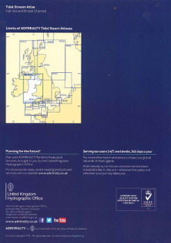
Admiralty Tidal Stream Atlas - NP256 Irish Sea & Bristol Channel - NP256
Admiralty
PLN122.43Admiralty Tidal Stream Atlas NP256 covering Irish Sea and Bristol Channel - Tidal Stream Atlases include detailed tidal stream direction and strength information for key locations in North West Europe enabling accurate calculation of tidal stream rates...49577PLN122.43 -

ADMIRALTY Chart 2129: Long Island Bay to Castlehaven
Admiralty
PLN221.08ADMIRALTY Chart 2129: Long Island Bay to Castlehaven Specifications Scale: 1:30000 Manufacturer: ADMIRALTY Publisher: ADMIRALTY Author: UK Hydrographic Office Edition: Feb-02 Format: Folded to approximately 71.5 x 53...49700PLN221.08 -

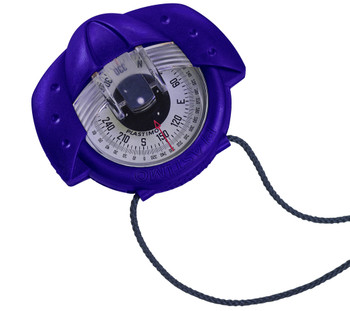
Plastimo Iris 50 Hand bearing Compass with Night Illumination - Blue
Plastimo
PLN400.02The Plastimo Iris 50 is simply the best selling hand bearing compass on the market. Waterproof, shockproof and compact, the Iris 50 fits neatly into your hand and despite its small size, is easy and clear to read. View through the prism to use as a hand...P63870PLN400.02 -
NEW!

Reeds Western Almanac 2024 Ireland & West UK
Reeds
PLN216.61The Reeds Western Almanac covers the coastline from Cape Wrath to Padstow as well as the whole of Ireland, and is ideal for any boater lucky enough to cruise and race in the superb waters off the coast of Western Scotland, Ireland or Western...49570/24PLN216.61 -

Silva 58 Kayak Compass
Silva
PLN362.35The Silva Kayak 58 compass is perfect for kayaking or any other small vessels. The compass itself is a liquid filled compass specially designed for marine navigation for accurate readings and a special strap with hooks that can fit this compass onto any...56190/2PLN362.35 -

Imray C54 Galway Bay to Donegal Bay Chart
Imray
PLN164.58Imray C54 Galway Bay to Donegal Bay Chart Includes Sligo Harbour (1:70 000) Broad Haven Bay (1:75 000) Portnafrankagh (Frenchport) (1:25 000) Achill Sound (1:70 000) Approaches to Westport (1:45 000) Bofin Harbour (Inishbofin) (1:20 000) Cleggan Bay...49554PLN164.58
A great selection of navigational equipment and instruments - compasses, binoculars, monoculars, barometers, weather instruments, flags, chart equipment, imray charts, sailing books and more from quality brands like Admiralty, Imray, Plastimo, Silva, Weems & Plath, Velocitek and others.


