NAVIGATION-CHARTS-BOOKS
-

ADMIRALTY Chart 2198: North Channel Southern Part
Admiralty
€46.95ADMIRALTY Chart 2198: North Channel Southern Part Specifications Scale: 1:75000 Manufacturer: ADMIRALTY Publisher: ADMIRALTY Author: UK Hydrographic Office Edition: Jan-18 Format: Folded to approximately 71.5 x 53.5cm,...49690/35€46.95 -

ADMIRALTY Chart 2254: Valentia Island to River Shannon
Admiralty
€46.95ADMIRALTY Chart 2254: Valentia Island to River Shannon Specifications Scale: 1:150000 Manufacturer: ADMIRALTY Publisher: ADMIRALTY Author: UK Hydrographic Office Edition: Nov-16 Format: Folded to approximately 71.5 x 53...49711€46.95 -

ADMIRALTY Chart 2420: Aran Islands to Broad Haven Bay
Admiralty
€46.95ADMIRALTY Chart 2420: Aran Islands to Broad Haven Bay Specifications Scale: 1:150000 Manufacturer: ADMIRALTY Publisher: ADMIRALTY Author: UK Hydrographic Office Edition: Jul-16 Format: Folded to approximately 71.5 x...49712€46.95 -

ADMIRALTY Chart 2423: Mizen Head to Dingle Bay
Admiralty
€46.95ADMIRALTY Chart 2423: Mizen Head to Dingle Bay Specifications Scale: 1:150000 Manufacturer: ADMIRALTY Publisher: ADMIRALTY Author: UK Hydrographic Office Edition: Nov-16 Format: Folded to approximately 71.5 x 53.5cm,...49713€46.95 -

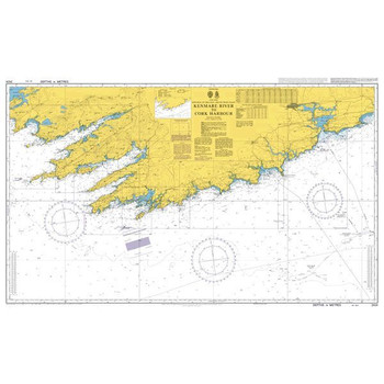
ADMIRALTY Chart 2424: Kenmare River to Cork Harbour
Admiralty
€46.95ADMIRALTY Chart 2424: Kenmare River to Cork Harbour Specifications Scale: 1:150000 Manufacturer: ADMIRALTY Publisher: ADMIRALTY Author: UK Hydrographic Office Edition: Nov-16 Format: Folded to approximately 71.5 x 53.5cm,...49712/04€46.95 -

ADMIRALTY Chart 2495: Kenmare River
Admiralty
€46.95ADMIRALTY Chart 2495: Kenmare River Specifications Scale: 1:60000 Manufacturer: ADMIRALTY Publisher: ADMIRALTY Author: UK Hydrographic Office Edition: Nov-16 Format: Folded to approximately 71.5 x 53.5cm, containing at...49715€46.95 -

ADMIRALTY Chart 2510: Approaches to Londonderry
Admiralty
€46.95ADMIRALTY Chart 2510: Approaches to Londonderry Specifications Scale: 1:250000 Manufacturer: ADMIRALTY Publisher: ADMIRALTY Author: UK Hydrographic Office Edition: Jun-05 Format: Folded to approximately 71.5 x 53.5cm,...49690/7€46.95 -

ADMIRALTY Chart 2552: Dunmanus Bay
Admiralty
€46.95ADMIRALTY Chart 2552: Dunmanus Bay Specifications Scale: 1:30000 Manufacturer: ADMIRALTY Publisher: ADMIRALTY Author: UK Hydrographic Office Edition: Jul-11 Format: Folded to approximately 71.5 x 53.5cm, containing at least...49716€46.95 -

ADMIRALTY Chart 2565: Saint Agnes Head to Dodman Point Including the Isles of Scilly
Admiralty
€46.95ADMIRALTY Chart 2565: Saint Agnes Head to Dodman Point Including the Isles of Scilly Specifications Scale: 1:150000 Manufacturer: ADMIRALTY Publisher: ADMIRALTY Author: UK Hydrographic Office Edition: Sep-12 Format: Folded...49716/5€46.95 -

ADMIRALTY Chart 259: Baltic Sea
Admiralty
€46.95ADMIRALTY Chart 259: Baltic Sea Specifications Scale: 1:1500000 Manufacturer: ADMIRALTY Publisher: ADMIRALTY Author: UK Hydrographic Office Edition: Jul-16 Format: Folded to approximately 71.5 x 53.5cm, containing at least...49619/06€46.95 -

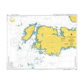
ADMIRALTY Chart 2617: Sound of Iona
Admiralty
€46.95ADMIRALTY Chart 2617: Sound of Iona Specifications Scale: 1:25000 Manufacturer: ADMIRALTY Publisher: ADMIRALTY Author: UK Hydrographic Office Edition: Jun-17 Format: Folded to approximately 71.5 x 53.5cm, containing at...49690/6€46.95 -

ADMIRALTY Chart 2649: Western Approaches to the English Channel
Admiralty
€46.95ADMIRALTY Chart 2649: Western Approaches to the English Channel Specifications Scale: 1:500000 Manufacturer: ADMIRALTY Publisher: ADMIRALTY Author: UK Hydrographic Office Edition: Feb-17 Format: Folded to approximately 71.5...49690/8€46.95
A great selection of navigational equipment and instruments - compasses, binoculars, monoculars, barometers, weather instruments, flags, chart equipment, imray charts, sailing books and more from quality brands like Admiralty, Imray, Plastimo, Silva, Weems & Plath, Velocitek and others.


