NAVIGATION-CHARTS-BOOKS
-

ADMIRALTY Chart 1840: Bantry Bay Black Ball Head to Shot Head
Admiralty
€46.95ADMIRALTY Chart 1840: Bantry Bay Black Ball Head to Shot Head Specifications Scale: 1:30000 Manufacturer: ADMIRALTY Publisher: ADMIRALTY Author: UK Hydrographic Office Edition: Feb-13 Format: Folded to approximately 71.5 x...49682€46.95 -

ADMIRALTY Chart 1879: Rathlin O'Birne Island to Aran Island
Admiralty
€46.95ADMIRALTY Chart 1879: Rathlin O'Birne Island to Aran Island Specifications Scale: 1:75000 Manufacturer: ADMIRALTY Publisher: ADMIRALTY Author: UK Hydrographic Office Edition: Jul-16 Format: Folded to approximately 71.5 x 53...49682/1€46.95 -

ADMIRALTY Chart 1904: Galway Harbour and Approaches
Admiralty
€46.95ADMIRALTY Chart 1904: Galway Harbour and Approaches Specifications Scale: 1:10000 Manufacturer: ADMIRALTY Publisher: ADMIRALTY Author: UK Hydrographic Office Edition: Jul-11 Format: Folded to approximately 71.5 x 53.5cm,...49682/6€46.95 -

ADMIRALTY Chart 1984: Galway Bay
Admiralty
€46.95ADMIRALTY Chart 1984: Galway Bay Specifications Scale: 1:30000 Manufacturer: ADMIRALTY Publisher: ADMIRALTY Author: UK Hydrographic Office Edition: Sep-11 Format: Folded to approximately 71.5 x 53.5cm, containing at least...49682/7€46.95 -

ADMIRALTY Chart 1994: Approaches to the River Clyde
Admiralty
€46.95ADMIRALTY Chart 1994: Approaches to the River Clyde Specifications Scale: 1:15000 Manufacturer: ADMIRALTY Publisher: ADMIRALTY Author: UK Hydrographic Office Edition: Dec-15 Format: Folded to approximately 71.5 x 53.5cm,...49682/9€46.95 -

ADMIRALTY Chart 2046: Waterford Harbour
Admiralty
€46.95ADMIRALTY Chart 2046: Waterford Harbour Specifications Scale: 1:25000 Manufacturer: ADMIRALTY Publisher: ADMIRALTY Author: UK Hydrographic Office Edition: Jan-17 Format: Folded to approximately 71.5 x 53.5cm, containing at...49714€46.95 -

ADMIRALTY Chart 2049: Old Head of Kinsale to Tuskar Rock
Admiralty
€46.95ADMIRALTY Chart 2049: Old Head of Kinsale to Tuskar Rock Specifications Scale: 1:150000 Manufacturer: ADMIRALTY Publisher: ADMIRALTY Author: UK Hydrographic Office Edition: Sep-12 Format: Folded to approximately 71.5 x 53...49683€46.95 -

ADMIRALTY Chart 2053: Kinsale Harbour and Oyster Haven
Admiralty
€46.95ADMIRALTY Chart 2053: Kinsale Harbour and Oyster Haven Specifications Scale: 1:12500 Manufacturer: ADMIRALTY Publisher: ADMIRALTY Author: UK Hydrographic Office Edition: Jun-13 Format: Folded to approximately 71.5 x 53.5cm,...49685€46.95 -

ADMIRALTY Chart 2057: Westport Bay and Approaches
Admiralty
€46.95ADMIRALTY Chart 2057: Westport Bay and Approaches Specifications Scale: 1:15000 Manufacturer: ADMIRALTY Publisher: ADMIRALTY Author: UK Hydrographic Office Edition: Aug-05 Format: Folded to approximately 71.5 x 53.5cm,...49686€46.95 -

ADMIRALTY Chart 2071: Youghal
Admiralty
€46.95ADMIRALTY Chart 2071: Youghal Specifications Scale: 1:12500 Manufacturer: ADMIRALTY Publisher: ADMIRALTY Author: UK Hydrographic Office Edition: Oct-91 Format: Folded to approximately 71.5 x 53.5cm, containing at least one...49687€46.95 -

ADMIRALTY Chart 2081: Courtmacsherry Bay
Admiralty
€46.95ADMIRALTY Chart 2081: Courtmacsherry Bay Specifications Scale: 1:25000 Manufacturer: ADMIRALTY Publisher: ADMIRALTY Author: UK Hydrographic Office Edition: Nov-16 Format: Folded to approximately 71.5 x 53.5cm, containing at...49705€46.95 -

ADMIRALTY Chart 2092: Toe Head to Old Head of Kinsale
Admiralty
€46.95ADMIRALTY Chart 2092: Toe Head to Old Head of Kinsale Specifications Scale: 1:50000 Manufacturer: ADMIRALTY Publisher: ADMIRALTY Author: UK Hydrographic Office Edition: Nov-16 Format: Folded to approximately 71.5 x 53.5cm,...49690€46.95 -

ADMIRALTY Chart 2093: Southern Approach to North Channel
Admiralty
€46.95ADMIRALTY Chart 2093: Southern Approach to North Channel Specifications Scale: 1:100000 Manufacturer: ADMIRALTY Publisher: ADMIRALTY Author: UK Hydrographic Office Edition: Mar-17 Format: Folded to approximately 71.5 x 53...49690/1€46.95 -

ADMIRALTY Chart 2096: Cashla Bay to Kilkieran Bay
Admiralty
€46.95ADMIRALTY Chart 2096: Cashla Bay to Kilkieran Bay Specifications Scale: 1:30000 Manufacturer: ADMIRALTY Publisher: ADMIRALTY Author: UK Hydrographic Office Edition: Aug-11 Format: Folded to approximately 71.5 x 53.5cm,...49690/4€46.95 -

Admiralty Chart 20: Ile d'Ouessant to Pointe de la Coubre
Admiralty
€46.95Admiralty Chart 20: Ile d'Ouessant to Pointe de la Coubre Specifications Scale: 1:500000 Manufacturer: ADMIRALTY Publisher: ADMIRALTY Author: UK Hydrographic Office Edition: Aug-18 Format: Folded to approximately 71.5 x 53...49605€46.95 -

ADMIRALTY Chart 2125: Valentia Island
Admiralty
€46.95ADMIRALTY Chart 2125: Valentia Island Specifications Scale: 1:30000 Manufacturer: ADMIRALTY Publisher: ADMIRALTY Author: UK Hydrographic Office Edition: Sep-12 Format: Folded to approximately 71.5 x 53.5cm, containing at...49707€46.95 -

ADMIRALTY Chart 2129: Long Island Bay to Castlehaven
Admiralty
€46.95ADMIRALTY Chart 2129: Long Island Bay to Castlehaven Specifications Scale: 1:30000 Manufacturer: ADMIRALTY Publisher: ADMIRALTY Author: UK Hydrographic Office Edition: Feb-02 Format: Folded to approximately 71.5 x 53...49700€46.95 -

ADMIRALTY Chart 2173: Loop Head to Slyne Head
Admiralty
€46.95ADMIRALTY Chart 2173: Loop Head to Slyne Head Specifications Scale: 1:150000 Manufacturer: ADMIRALTY Publisher: ADMIRALTY Author: UK Hydrographic Office Edition: Nov-16 Format: Folded to approximately 71.5 x 53.5cm,...49690/2€46.95 -

ADMIRALTY Chart 2184: Mizen Head to Gascanane Sound
Admiralty
€46.95ADMIRALTY Chart 2184: Mizen Head to Gascanane Sound Specifications Scale: 1:30000 Manufacturer: ADMIRALTY Publisher: ADMIRALTY Author: UK Hydrographic Office Edition: Aug-12 Format: Folded to approximately 71.5 x 53.5cm,...49710€46.95 -

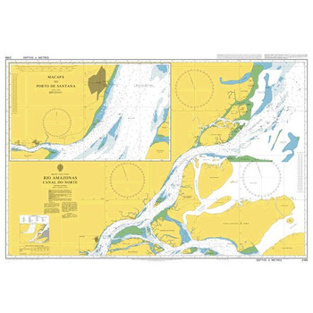
ADMIRALTY Chart 2189: Rio Amazonas - Canal Do Norte
Admiralty
€46.95ADMIRALTY Chart 2189: Rio Amazonas - Canal Do Norte Specifications Scale: 1:250000 Manufacturer: ADMIRALTY Publisher: ADMIRALTY Author: UK Hydrographic Office Edition: Sep-17 Format: Folded to approximately 71.5 x 53...49690/3€46.95
A great selection of navigational equipment and instruments - compasses, binoculars, monoculars, barometers, weather instruments, flags, chart equipment, imray charts, sailing books and more from quality brands like Admiralty, Imray, Plastimo, Silva, Weems & Plath, Velocitek and others.


