
C-Map
C-MAP Reveal GPS Chart UK & Ireland M-EW-Y226-MS
- SKU:
- 57798/Reveal
- UPC:
- 8053800670579
- MPN:
- EW-Y226-MS


Description
IMPORTANT – PLEASE CHECK YOUR EXACT CHARTPLOTTER MODEL FOR COMPATIBILITY BEFORE ORDERING. C-MAP REVEAL IS COMPATIBLE WITH SELECTED LOWRANCE, SIMRAD AND B&G CHARTPLOTTERS, BUT IT IS NOT COMPATIBLE WITH EVERY MODEL. X-GENERATION CHARTPLOTTERS REQUIRE C-MAP REVEAL X OR DISCOVER X.
Whether cruising, fishing or sailing, C-MAP REVEAL provides C-MAP’s premium cartography for compatible Lowrance, Simrad and B&G chartplotters.
REVEAL includes the essential navigation features found in C-MAP DISCOVER, including full-featured vector charts, Custom Depth Shading, tides and currents, detailed harbour information and subscription-free Easy Routing.
It also adds premium visual layers, including REVEAL Shaded Relief, Satellite Overlay, aerial photography and Dynamic Raster Charts. These layers provide a more detailed representation of seabed structure, coastal features and traditional paper-chart information.
The purchase includes 12 months of free online chart updates.
Key Features
- Large coverage of the United Kingdom and Ireland
- Full-featured vector charts
- High-resolution bathymetry
- REVEAL Shaded Relief
- Satellite Overlay
- Aerial photography
- Dynamic Raster Charts
- Custom Depth Shading
- Tides and currents
- Subscription-free Easy Routing
- Detailed marina port plans
- Harbour and approach details
- 12 months of free online updates
Premium REVEAL Layers
Shaded Relief
Provides a rendered representation of underwater elevation and seabed structure, making contours, drop-offs and other underwater features easier to identify.
Satellite Overlay and Aerial Photography
Adds overhead imagery to improve awareness of coastlines, harbours, entrances and surrounding land features.
Dynamic Raster Charts
Provides the familiar appearance of a traditional paper chart while allowing the chart information to be displayed dynamically on a compatible chartplotter.
The availability and level of detail of premium layers may vary by geographical area.
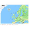
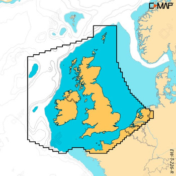
Official Chart Coverage
United Kingdom and Ireland
C-MAP classifies M-EW-Y226-MS as a Large coverage chart.
Please check the official coverage image to confirm that your intended cruising area is included.
Chartplotter Compatibility
PLEASE CONFIRM THE COMPLETE MAKE AND MODEL OF YOUR CHARTPLOTTER BEFORE ORDERING.
C-MAP REVEAL is designed for selected:
- Lowrance chartplotters
- Simrad chartplotters
- B&G chartplotters
Compatibility depends on the exact model, generation, installed software and available chart-card slot. Compatibility with one model from a brand does not guarantee compatibility with every chartplotter made by that brand.
Not Compatible With X-Generation Chartplotters
This standard REVEAL chart is not intended for chartplotters that require C-MAP X-Generation cartography, including:
- Simrad NSX
- Simrad NSX Ultrawide
- Simrad NSS 4
- Simrad NSO 4
- B&G Zeus S
- B&G Zeus S Ultrawide
- B&G Zeus SR
- B&G Zeus SRX
These models require a compatible C-MAP REVEAL X or DISCOVER X chart.
It is also not designed for Garmin or Raymarine chartplotters.
Specifications
| Specification | Details |
|---|---|
| Manufacturer | C-MAP |
| Chart Range | REVEAL |
| Manufacturer Part Number | M-EW-Y226-MS |
| CH Marine SKU | 57798/Reveal |
| EAN/UPC | 8053800670579 |
| Official Coverage | United Kingdom and Ireland |
| Coverage Size | Large |
| Compatible Brands | Selected Lowrance, Simrad and B&G chartplotters |
| Shaded Relief | Yes |
| Satellite Overlay | Yes |
| Dynamic Raster Charts | Yes |
| Online Chart Updates | 12 months free |
What’s Included?
- 1 × C-MAP REVEAL United Kingdom and Ireland chart card
- 12 months of free online chart updates
Navigation Notice
Easy Routing provides a suggested route based on available chart data and the vessel information entered into the chartplotter. Every suggested route must be checked against current conditions, official navigation information, vessel limitations and local restrictions.
Related Products
Related Products

C-Map Reveal X Chart UK & Ireland M-EW-T-226-R-MS
C-Map


C-MAP Discover Chart UK & Ireland - EW-Y200-MS
C-Map

C-Map Discover X Chart UK & Ireland M-EW-T-226-D-MS
C-Map

C-MAP DISCOVER CENTRAL & WEST EUROPE CONTINENTAL – M-EW-Y060-MS
C-Map

Navionics+ Ireland, UK and Holland Chart - MSD/SD Card
Navionics