
Navionics
Garmin Navionics Vision+ Electronic Chart - UK, IRL Rivers & Lakes
- SKU:
- G010-C1267-00
- UPC:
- 753759290412


Description
Garmin Navionics Vision+ detailed coverage of major lakes and rivers of the UK and Ireland. Coverage includes the Thames, Medway, Mersey, Avon and Tweed Rivers in the UK and the Shannon River in Ireland. Lake coverage includes Lock Ness, Loch Lochy and Lough Neagh in the UK.
Garmin Navionics+ & Garmin Navionics Vision+ are exclusivley for use in Garmin Chartplotters. For non Garmin Chartplotters see Navionics+ & Navionics Platinum+ Charts
Specification
| Navionics Vision+ | |
| Coastal Content | • |
| Inland Content | 42,000+ lakes |
| Detailed Nautical Charts | • |
| Up To 1' Contours | • |
| Daily Updates1 | Via ActiveCaptain App |
| Auto Guidance+ Technology2 | • |
| ActiveCaptain® App Support | • |
| ActiveCaptain Community | • |
| Depth Range Shading | • |
| Shallow Water Shading | • |
| Dynamic Lake Level | • |
| High-Resolution Relief Shading1 | Via ActiveCaptain App |
| High-Resolution Satellite Imagery1 | Via ActiveCaptain App |
| Aerial Photography | • |
| 3D Fisheye View | • |
| 3D Marinereye View | • |
Memory Card
- SD/ Micro SD Card
Related Products
Related Products
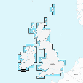
Garmin Navionics+ Chart - UK, IRL Rivers & Lakes
Garmin
Current Stock: 0
€153.95
IMPORTANT COMPATIBILITY NOTICE
PLEASE CHECK YOUR CHARTPLOTTER’S COMPATIBILITY BEFORE PURCHASING. THIS CARD IS DESIGNED EXCLUSIVELY FOR COMPATIBLE GARMI
G010-C1267-20


Garmin Navionics Vision+ Chart - IRL , UK & NL
Garmin
Current Stock: 2
€327.95
IMPORTANT – THIS CHART IS DESIGNED EXCLUSIVELY FOR COMPATIBLE GARMIN CHARTPLOTTERS. PLEASE CHECK YOUR EXACT CHARTPLOTTER MODEL FOR GARMIN NAVIONICS VISION+ COMPATIBILITY BEFORE ORDERING.
The
G010-C1271-00


Garmin Navionics Vision+ Chart - Irish Sea
Navionics
Current Stock: 0
€245.95
IMPORTANT – THIS CHART IS DESIGNED EXCLUSIVELY FOR COMPATIBLE GARMIN CHARTPLOTTERS. PLEASE CHECK YOUR EXACT CHARTPLOTTER MODEL FOR GARMIN NAVIONICS VISION+ COMPATIBILITY BEFORE ORDERING.
The
G010-C1232-00
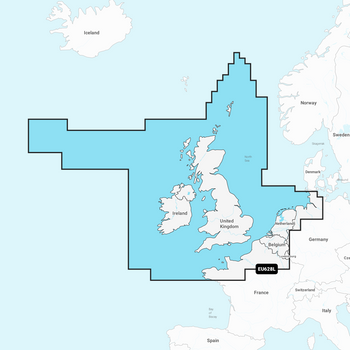
Garmin Navionics+ Chart – UK, Ireland & Holland NSEU628L
Garmin
Current Stock: 0
€235.95
Explore the waters of the United Kingdom, Ireland, the Netherlands and surrounding European coastlines with detailed Garmin Navionics+ marine cartography.
Supplied on a pre-programmed microSD card...
G010-C1271-20

Garmin Navionics Vision+ / Navionics Platinum+ Regular Chart Card – EMEA
Garmin
Current Stock: 3
€261.95
The Garmin 010-13887-00 is a dealer-programmable premium Regular-size marine chart card for Europe, the Middle East and Africa.The selected coverage area and correct chart format will be programmed...
G010-13887-00