
Navionics
Navionics Platinum+ Italy / Adriatic Sea Chart - MSD/SD Card
- SKU:
- G010-C1318-40
- UPC:
- 8054242923636
- MPN:
- NAV+28XG/UK

Description
IMPORTANT – PLEASE CHECK YOUR EXACT CHARTPLOTTER MODEL FOR NAVIONICS PLATINUM+ COMPATIBILITY BEFORE ORDERING. BASIC CHART AND PREMIUM FEATURE COMPATIBILITY VARIES BETWEEN CHARTPLOTTER MODELS.
The Navionics Platinum+ NPEU014R Italy and Adriatic Sea chart provides premium cartography for compatible chartplotters.
Coverage includes the Adriatic coasts of Italy, Slovenia, Croatia and Albania, together with the western coast of Greece and southern Italy. It also includes eastern Sicily, the Strait of Messina, the Dalmatian Coast, the Gulf of Taranto and selected major Italian lakes.
Platinum+ includes detailed Nautical Chart cartography, SonarChart HD bathymetry and Community Edits. Premium visual layers include Relief Shading, Satellite Overlay, SonarChart Shading, panoramic port photographs and three-dimensional views.
A one-year subscription to chart updates and supported advanced features is included.
Key Features
- Detailed Italy and Adriatic Sea coverage
- Nautical Chart marine cartography
- SonarChart HD bathymetry
- Community Edits
- Relief Shading
- Satellite Overlay
- SonarChart Shading
- Panoramic port photographs
- Three-dimensional chart views
- Dock-to-Dock Route Guidance
- Advanced Map Options
- SonarChart Live
- Plotter Sync on compatible equipment
- One-year subscription to chart updates
- microSD/SD chart-card format
Chart Coverage
NPEU014R provides coverage of:
- Po River
- Adriatic coast of Italy
- Slovenia
- Croatia and the Dalmatian Coast
- Albania
- Western coast of Greece
- Southern Italy
- Eastern Sicily
- Strait of Messina
- Gulf of Taranto
- Lake Maggiore
- Lake Iseo
- Lake Como
- Lake Garda
PLEASE CHECK THE OFFICIAL NPEU014R COVERAGE IMAGE TO CONFIRM THAT YOUR REQUIRED NAVIGATION AREA IS INCLUDED.
Premium Platinum+ Features
Relief Shading
Uses colour and shadow to provide a clearer representation of underwater elevation and seabed structure. Relief Shading is downloaded using Navionics Chart Installer.
Satellite Overlay with SonarChart Shading
Combines satellite imagery with detailed bathymetric information to improve awareness of coastal and underwater features.
Panoramic Port Photographs
Provides photographs of selected ports, marinas and entrances to assist when approaching unfamiliar locations.
Three-Dimensional Views
Displays chart and underwater information in a three-dimensional format on compatible chartplotters.
Premium content availability varies by geographical area and chartplotter model.
One-Year Subscription
The purchase includes a one-year Navionics subscription, providing access to chart updates and supported advanced features.
Updates are installed using Navionics Chart Installer on an internet-connected computer with a suitable card reader.
After the subscription expires, the installed charts remain available. Subscription renewal is required to continue receiving updates and subscription-dependent content.
Chartplotter Compatibility
This Navionics Platinum+ chart is compatible with a wide range of chartplotters that accept Navionics charts on microSD/SD media.
B&G
Zeus3S, Zeus3S Glass Helm, Zeus3, Zeus3 Glass Helm, Zeus2, Zeus2 Glass Helm, Zeus Touch, Zeus and Vulcan 5/7/7R/7FS/9/12.
Simrad
NSS evo3S, NSS evo3, NSO evo3S, GO5 XSE, GO9 XSE, GO12 XSE and GO XSR.
Lowrance
HDS PRO, HDS LIVE, HDS Carbon, HDS Gen3, HDS Gen2/Gen2 Touch, HDS Gen1, Elite FS, Elite Ti², Elite Ti, HOOK Reveal, HOOK² Combo, HOOK CHIRP and Eagle chartplotters.
For HOOK, HOOK², HOOK Reveal and Eagle devices, only chart-capable non-X models are compatible.
Raymarine
Axiom 2, Axiom+, Axiom Pro, Axiom XL, Axiom, Element S, Element HV, eS-Series, e-Series, gS-Series, c-Series, a-Series, Dragonfly Pro and Dragonfly.
Humminbird
XPLORE, APEX, SOLIX G1/G2/G3, ONIX, ION, HELIX G2/G2N/G3/G3N/G4N and selected first-generation HELIX models.
Furuno
GP-1871F and GP-1971F.
Important: This card is not compatible with Garmin chartplotters. It is also incompatible with Simrad NSX, NSX ULTRAWIDE, NSS 4 and NSO 4 or B&G Zeus S, Zeus S ULTRAWIDE, Zeus SR and Zeus SRX; these NEON OS devices require C-MAP DISCOVER X or REVEAL X charts.
The chartplotter should be running its latest available firmware. Feature support—including Relief Shading, satellite imagery, 3D View, panoramic photographs, Dock-to-Dock Route Guidance and Plotter Sync—varies by device.
Specifications
| Specification | Details |
|---|---|
| Manufacturer | Navionics |
| Chart Range | Platinum+ |
| Manufacturer Part Number | 010-C1318-40 |
| CH Marine SKU | G010-C1318-40 |
| Chart Code | NPEU014R |
| Chart Name | Italy, Adriatic Sea |
| Coverage Size | Regular |
| Card Format | microSD/SD |
| Cartography | Pre-programmed |
| Included Subscription | One year |
| Relief Shading | Yes |
| Satellite Overlay | Yes |
| SonarChart HD | Yes |
| Panoramic Port Photographs | Yes |
| Three-Dimensional Views | Yes |
What’s Included?
- 1 × Navionics Platinum+ NPEU014R Italy and Adriatic Sea chart card
- One-year subscription to chart updates and supported advanced features
Route-Guidance Notice
Dock-to-Dock Route Guidance is intended for planning purposes only. Suggested routes must be checked against official navigation information, current conditions, vessel limitations and local restrictions.
Related Products
Related Products
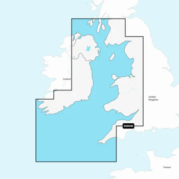
Navionics Platinum+ Irish Sea Chart - MSD/SD Card
Navionics

Navionics Platinum+ Ireland West Coast Chart - MSD/SD Card
Navionics

Navionics+ Ireland, UK and Holland Chart - MSD/SD Card
Navionics

Navionics Platinum+ UK, Ireland & Holland - MSD/SD Card
Navionics

Garmin Navionics Vision+ / Navionics Platinum+ Large Chart Card – EMEA
Garmin