

Description
IMPORTANT COMPATIBILITY NOTICE
PLEASE CHECK YOUR CHARTPLOTTER’S COMPATIBILITY BEFORE PURCHASING. THIS CARD IS DESIGNED EXCLUSIVELY FOR COMPATIBLE GARMIN CHARTPLOTTERS. IT WILL NOT WORK IN LOWRANCE, SIMRAD, B&G, RAYMARINE OR OTHER THIRD-PARTY CHARTPLOTTERS.
THIS IS PRIMARILY AN INLAND LAKES AND RIVERS CHART. IT SHOULD NOT BE PURCHASED AS A REPLACEMENT FOR DETAILED U.K. OR IRELAND COASTAL CARTOGRAPHY.
Garmin Navionics+ EU072R combines detailed Garmin and Navionics inland mapping in a pre-programmed microSD/SD chart card for compatible Garmin chartplotters.
The cartography features a modern Navionics-style colour palette, detailed depth contours, navigational information, Auto Guidance+ technology and customisable depth shading. A one-year subscription to daily chart updates is included.
Coverage Area
Detailed coverage of major navigable lakes, rivers and inland waterways in the United Kingdom and Ireland, including:
Ireland
- Shannon River
- Shannon Navigation
- Shannon–Erne Waterway
- Lough Neagh
- Other supported Irish lakes and inland waterways within the EU072R chart boundary
United Kingdom
- River Thames
- River Medway
- River Mersey
- River Avon
- River Tweed
- Loch Ness
- Loch Lochy
- Other supported British lakes, rivers and navigable waterways
CUSTOMERS SHOULD CHECK THE OFFICIAL GARMIN COVERAGE MAP TO CONFIRM THAT THEIR REQUIRED LAKE, RIVER OR WATERWAY IS INCLUDED.
Key Features
- Detailed U.K. and Ireland inland cartography
- Integrated Garmin and Navionics chart data
- Up to approximately 0.5-metre depth contours in supported areas
- Auto Guidance+ technology
- Depth Range Shading
- Shallow Water Shading
- ActiveCaptain Community information
- Customisable chart layers and overlay combinations
- Daily chart updates during the included subscription
- Pre-programmed microSD card with SD adapter
Auto Guidance+
Auto Guidance+ uses chart data and user-defined vessel information to calculate a suggested dock-to-dock route through supported waterways.
Feature availability depends on the connected Garmin chartplotter. Suggested routes must always be checked by the vessel operator.
Depth Range Shading
Up to ten colour-shaded depth ranges can be selected on compatible chartplotters, making it easier to identify target depths and underwater structure.
Shallow Water Shading
The operator can specify a minimum depth and highlight potentially shallow areas on the chart. This feature is intended to improve situational awareness and does not replace depth monitoring or safe navigation.
ActiveCaptain Community
Compatible Garmin chartplotters can display community-sourced information such as:
- Marinas
- Anchorages
- Hazards
- Local businesses
- Points of interest
- Comments and recommendations from other boaters
One-Year Subscription
The card includes a one-year subscription providing access to daily chart updates through the Garmin ActiveCaptain app.
After the subscription expires, the installed charts remain available. Renewing the subscription is required to continue receiving daily updates and eligible downloadable content.
Chartplotter Compatibility
This card is designed only for compatible Garmin chartplotters, including selected models from these families:
- Garmin ECHOMAP UHD
- Garmin ECHOMAP Ultra
- Garmin ECHOMAP UHD2
- Garmin GPSMAP x2 series
- Garmin GPSMAP x2 Plus series
- Garmin GPSMAP x3 series
- Garmin GPSMAP 8400/8600 series
- Garmin GPSMAP 8700 Black Box
THE PRODUCT FAMILY ALONE DOES NOT GUARANTEE COMPATIBILITY. PLEASE VERIFY THE EXACT MODEL, SOFTWARE VERSION AND CARD-SLOT REQUIREMENTS BEFORE ORDERING.
Garmin Navionics+ or Vision+?
This product is the standard Garmin Navionics+ version.
It does not include Garmin Navionics Vision+ premium features such as:
- High-resolution Relief Shading
- Satellite Imagery
- Aerial photographs
- 3D FishEye and MarinerEye views
Specifications
| Specification | Details |
|---|---|
| Product | Garmin Navionics+ U.K. & Ireland Lakes & Rivers |
| Garmin part number | 010-C1267-20 |
| Region code | EU072R |
| Chart code | NSEU072R |
| Geographic coverage | U.K. and Ireland inland waterways |
| Chart series | Garmin Navionics+ |
| Card status | Pre-programmed |
| Card format | microSD card with SD adapter |
| Customer programming required | No |
| Included subscription | One year |
| Daily chart updates | Yes, during active subscription |
| Auto Guidance+ | Compatible devices only |
| Depth Range Shading | Yes |
| Shallow Water Shading | Yes |
| Relief Shading | No |
| Compatible brands | Garmin only |
What’s Included
- Garmin Navionics+ EU072R pre-programmed microSD chart card
- Full-size SD card adapter
- One-year chart-update subscription
Navigation Notice
Auto Guidance+ and electronic charts are navigation aids only. They do not replace official charts, local navigation rules, depth measurements, notices to mariners, safe seamanship or the judgment of the vessel operator.
Related Products
Related Products


Garmin Navionics Vision+ Electronic Chart - UK, IRL Rivers & Lakes
Navionics
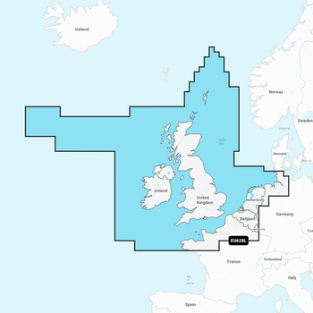
Garmin Navionics+ Chart – UK, Ireland & Holland NSEU628L
Garmin


Garmin Navionics Vision+ Chart - IRL , UK & NL
Garmin
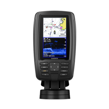
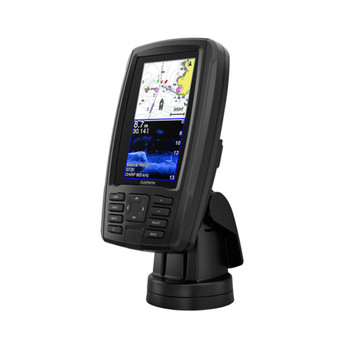
Garmin Echomap Plus 45cv w UK, IRL & NL Charts
Garmin


Garmin Echomap 5" UHD2 55cv with UK, IRL & NL Chart
Garmin